Group every map layer
Keep markers, routes, text labels, and polygons in folders so large projects stay readable.
TrailNote is a collaborative map workspace for hiking, cycling, and field planning. Build routes, drop markers, add notes and photos, then share projects or export GPX.
Build hiking routes with trailheads, viewpoints, water stops, and route notes in a map that stays GPX-ready.
Learn moreMark hazards, meeting points, camps, labels, and boundaries with markers, text, polygons, and styled routes.
Learn moreSketch missing trail segments and custom connectors directly on the map when routing data cannot capture the real path.
Learn moreStore routes, notes, dates, and status in one place so planning does not spill across docs, chats, and screenshots.
TrailNote gives you a clear project view from first draft to finished outing.
Open your workspace
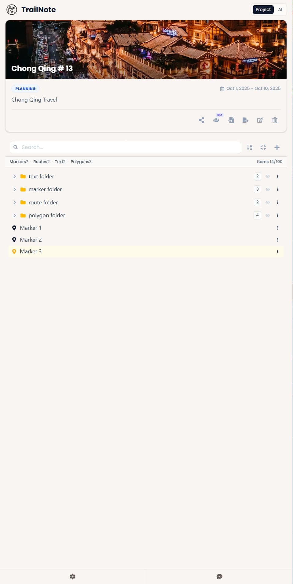
TrailNote's folder tree turns busy route plans into a clean, structured workspace. Organize every marker, route, label, and polygon by day, area, topic, or planning stage.
Keep markers, routes, text labels, and polygons in folders so large projects stay readable.
Hide or reveal folder groups while reviewing a route, sharing a cleaner map, or comparing options.
Move related items into the right folder as a trip grows from rough ideas into a finished plan.
TrailNote keeps collaboration simple for clubs, guide teams, and field crews: invite members, assign roles, and coordinate edits in one shared map project.
See team plans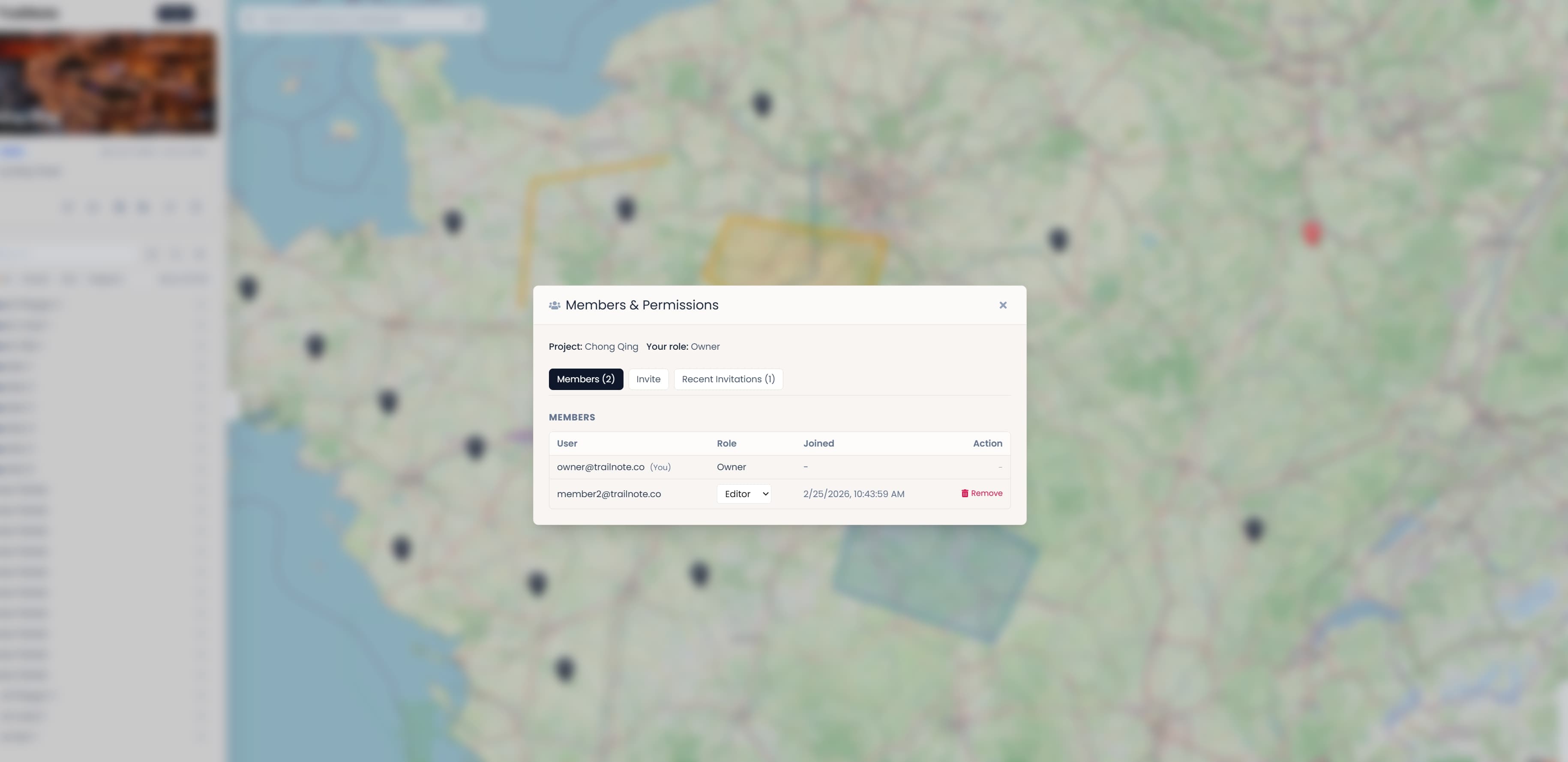
01
Invite guides, teammates, or trip members into the same project instead of passing around separate files.
02
Assign Owner, Admin, Editor, or Viewer so each person can review or edit at the right level.
03
Review active members, update roles, and keep pending invitations visible as the project grows.
"Plan the weekend route, mark water stops and meeting points, and send one clear map to the whole hiking group before everyone heads out."
Weekend Hiking Groups
Trip Coordination
"When standard routing breaks, freehand drawing and annotations make it possible to finish the exact trail map without switching tools."
Outdoor Guide Teams
Custom Route Mapping
"Permissions keep one shared project usable for the entire team, so planners, reviewers, and editors can work from the same map without chaos."
Field Planning Teams
Shared Project Control
Create a free account to draw routes, annotate maps, and organize outdoor projects without bouncing between tools.